April 22, 2020
From the Captain’s Log
A Note on Weather and Navigation
Someone watching our progress on the PredictWind tracking site might wonder why we’ve taken the course we have during the passage from Mexico to Hawaii. After all, we have gone quite a way south of our destination; and further still from a Great Circle Route (shortest course on a globe) or even the Rhumb Line (shortest course on a Mercator Projection chart). The answer has to do with the fact that ESTELLE is a sailing vessel, using wind energy generated by weather systems as her primary means of propulsion. Ocean current plays a factor too, but it is primarily a weather / wind issue. Were ESTELLE a motor vessel, we would have programmed the Great Circle route into the autopilot and gone about our business, starting the cribbage tournament early. But, as a sailing vessel, it is not that simple.

The dominant weather system in the Eastern North Pacific during this time of year is the Pacific High, a zone of high pressure which sits between the West Coast of the US and Hawaii. The Pacific High interacts with various low pressure systems and associated fronts. Wind is created by air moving from high pressure to low pressure regions. In the northern hemisphere, this wind moves in a clockwise direction out of the high pressure zone, and the wind’s direction changes depending on where you are relative to the center of the high. At the risk of over simplifying, if you think of the Pacific High as a clock face, we moved from the 4 o’clock to the 6 o’clock to the 7 o’clock positions on the passage from Mexico to Hawaii.
Once ESTELLE rounded Los Cabos (the southern Cape of Baja), and entered the Pacific Ocean from the Sea of Cortez, we were in predominantly NW winds — generated by the Pacific High, and effected by the topography and piling-up of wind along / down the Baja Peninsula. The so-called Cape effect — the mix of different sea and wind systems — can make for unsettled conditions and is notorious in this region. As we got further offshore, however, and the Cape effect diminished, the wind veered from NW to N and eventually to NE. We entered the trade winds proper, dominated by the Pacific High. Trying to maintain a comfortable point of sail (we are a cruising yacht, after all, and in no particular hurry), we stayed on a beam reach as we left the main land which put us on a SW course.
As we moved from the 4 o’clock toward the 6 o’clock position relative to the high, the wind veered from NW to N, which lifted us to a more westerly course and allowed us to sail on a more comfortable broad reach. Moving from 6 o’clock to 7 c’clock, the wind veered further from N to NE, lifting us even more to a WNW course toward the islands with the wind directly behind us. Essentially, we have followed the bottom of the Pacific High, making modest adjustments to our point of sail as the wind direction changes relative to our intended course.
It is a different story from one day to the next, however, or even within the course of a single day. Especially on a cruising yacht being steered primarily by a wind vane, while the short-handed crew battles it out for sleep and the next round of the cribbage tournament. The Pacific High isn’t the only weather system in the region, and its interaction with low pressure and cold fronts can make for unexpected and unsettled conditions.
The other evening, for example, the wind increased significantly in strength and veered from NE to E and eventually to the SE. Not part of the theory. We had a series of squalls come through, dark clouds bringing rain and turbulent wind. As a result, our course shifted significantly from W to NW to N for a while. We made several adjustments to our sail configuration, including a double reef in the main and a deep reef in the genoa, and tried to stay on a broad reach. Since we needed to go north at some point anyway, and didn’t want to gybe in the middle of the night (cruisers, not racers; exhausted from cribbage and lacking in sleep due to the noise and motion), we rode through the unexpected change in conditions. We ended up a little farther north than we might have wanted to but, in the grand scheme of the passage, it was not a big deal.
Today, the wind is back to its typical ENE direction, we are running down wind, wing-on-wing again, right on course at a heading of 255-degrees magnetic. Wind speed is in the high-teens/low-twenties, gusting to 25+ kts; waves are in the 2-4 meter range, just off the starboard quarter; boat speed is 7.5 to 8.5 kts, surging to 10.5 kts on a surf. Sunny, warm, classic tropical trade winds sailing.
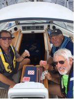
Tonight is the cribbage Rubber Match between the Geezers and the Youngsters! Go Youngsters!!

Nice explanation, Captain. The Predict Wind tracking site did not show the the change in local wind directions which you experienced. Nor has it ever shown any wind velocity over about 18-20K on any position report.
Good luck with finding a berth, quarantines, and getting into Canada. Doesn’t sound too bad if you were stuck in Hawaii for a while.
David
LikeLike
An awesome adventure! Sail on! May the wind be always at your back and the winning hand or domino or whatever be in your reach! Love, John and Erin
LikeLike